
How to Use the Nordic Alliance Trail Finder
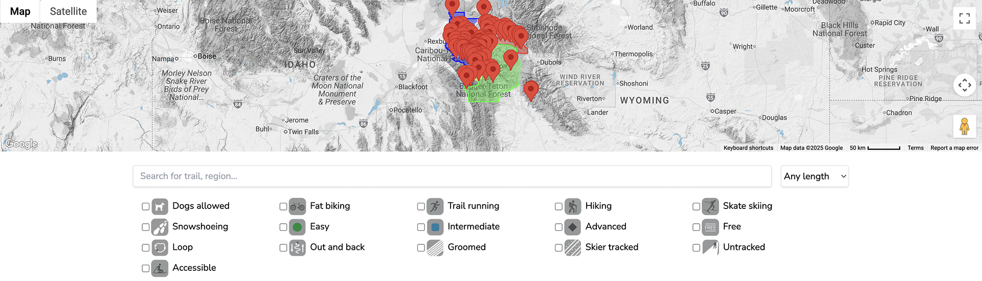
Welcome to the giant map of the greater Teton region, including Jackson Hole, Grand Teton National Park, Teton Valley, ID, and a few great spots further afield! The picture above is a STILL shot of the map - not interactive. We want to share a few tips for navigating the interactive map on the Find a Trail page.
Each red dot represents a trail.
Comprehensive trail pages
Each red dot shows the beginning point of a trail. When you click on a red dot, a new tab opens with a page about the trail (a Trail Page). The Trail Page includes a GPS map, directions, a description, parking info, elevation profile, etc. If it is a groomed trail, in the winter when grooming is happening, you will see the current grooming map. If it is a skier tracked, snowmachine packed or adventure trail, you will see a black and white map with a red GPS trail.
Zooming in or out on the map
Are the red dots too close together to even know what you are looking at? You can zoom in and out on the map by clicking on the circle right above the yellow person icon in the lower right hand corner of the map. That brings up a + - and directional arrows.
Want to see the map full screen? Click on the white square at the upper right corner of the map - when you are ready to reduce it, click on that same icon. When you are in full screen, you might also want to check out the terrain from a satellite view. You can toggle between map and satellite using the buttons in the upper left corner.
Use the search bar to narrow by trail or region.
If you already know the name of the trail you would like to find, start typing in the box where it says "Search for trail, region...". If not, here are some tips.
Main regions of the map
We have divided trails into general areas to help with searching. You can type a region into the search bar to see all of the mapped trails in that region. The regions are:
- Grand Teton National Park (white)
- Jackson (turquoise)
- Teton Valley (purple-blue)
- Togwotee Pass (red shade)
- West Yellowstone, MT (also in purple-blue)
- Wilson (yellow)
- Wyoming Range and Gros Ventres (light green)
Search by length
Use the drop down menu (the button that says "Any length") to specify a range of trail lengths.
Use the icons to create filters.
Click on any combination of icons when you are on the Find a Trail page to create a curated list that meets various criteria for activity, skill level, surface condition, dog-friendly, etc. A few points for context:
- Easy, intermediate and advanced are subjective, but intended to be a helpful guide.
- Free may mean that the trail is free because it is an ungroomed tour. It also can mean there is not a required day pass or fee on a groomed track. We specify "free" in part because we want people to get out on skis, and sometimes it helps if it is free! However, if you are in a position to contribute to help keep the grooming going, please do. See Support Trail Grooming for more info.
- Dogs are allowed on many trails. Popular trailheads mostly require dogs are on leash in the parking area, for the first bit of trail, anywher that is congested, and sometimes fro the duration of the trail. Check for signs at trailheads.
Share a new trail or send a trip report.
If you want to share a new trail with the winter trails community, or something is amiss with a current description, let us know! Trip reports, photos, feedback and inspiration are welcome at [email protected].