5.9 miles
Taggart Lake
Grand Teton National Park
Fee: $0.00
Access:
Via Teton Park Road in GTNP, 3.2 miles north of Moose. Park at the Taggart-Bradley Lakes parking lot.
Description:
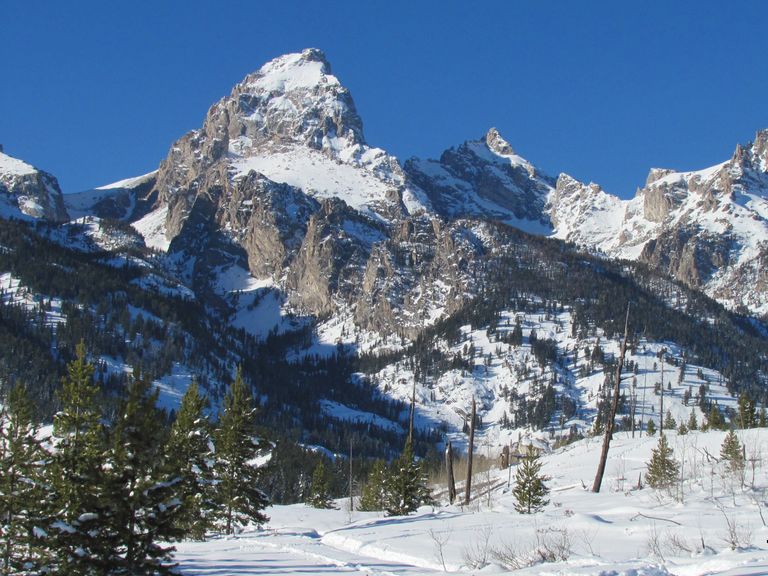
This skier-tracked trail leads to the serene Taggart Lake, offering views of the Grand Teton. The trail is suitable for intermediate skiers and features a gentle ascent through aspen trees, a creek crossing, and a steeper uphill stretch.
Parking: The trailhead is at the Taggart-Bradley Lakes parking lot. Ensure to park responsibly and display your entrance fee or National Park pass.
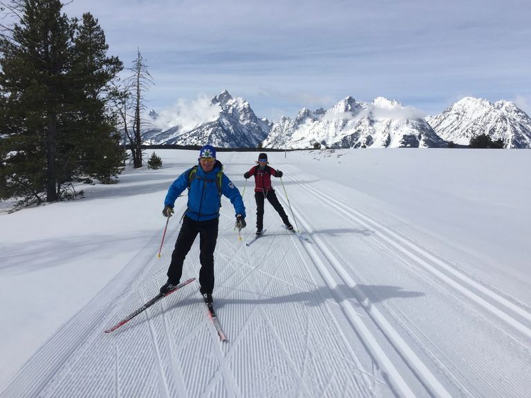
Skiing Experience: The trail is best for intermediate skiers due to its gentle ascents and steeper sections, which may require removing skis for easier navigation.
Winter Conditions: The trail is skier-tracked and not machine-groomed. Snow conditions can vary, so be prepared for ungroomed sections.
Summer Conditions: This trail is a popular summer hike. Follow the same route for hiking and enjoy the scenic views of Taggart and Bradley Lakes.
Seasonal Note: Early in the season, the lake may not be frozen enough to ski on, so do not venture onto the lake until well into the winter, after several weeks of consistently below-freezing conditions. Check with GTNP staff for current conditions.
Notes for Dog Owners: Dogs are not allowed on this trail within Grand Teton National Park.
Directions:
Beginnings: From the Taggart-Bradley Lakes parking lot, head due west for 500 yards along the ski tracks (summer hiking trail) across the open meadow.
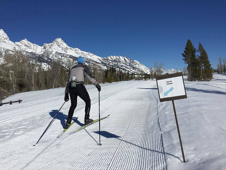
Uphill Stretch: The main XC ski trail turns right (north) to follow the summer hiking trail. The trail rises gradually, entering a grove of aspen trees, crosses a creek on a wooden bridge, and continues north, rising gradually above the horse ranch. After approximately 400 yards, the trail turns right (west) and heads uphill on a steeper grade. Some may prefer to remove their skis at this point, as the trail is only wide enough for a ski track. After about 500 yards of climbing, the trail levels out at the top of the forested moraine, offering a magnificent view of the Grand Teton.
Views: Continue west where the trail splits – left to Taggart Lake, right to Bradley Lake. Head left for another 1/3 mile through a forest of young pines, then an open meadow. Finally, take a right for 40 yards to reach Taggart Lake.
Return: Retrace the same path for the easiest descent.
Extended Exploration: For those wishing to continue on to Bradley Lake, retrace your path back to the split 1/3 mile before Taggart Lake. Refer to the Bradley Lake trail description for further details.
Alternate Return: Another variation for the return trip is to continue south from Taggart Lake, following the summer trail “Beaver Creek.” After leaving the lakeside at Taggart Lake, head south, cross the wood bridge over the creek draining Taggart (Beaver Creek). Continue south downhill, then traverse left (southeast) around the small hill/moraine. The ski track traverses the bottom of the hill above the meadow (on the skier’s right) for approximately ¾ mile (heading east by now), until you exit into the open meadow to rejoin the final 500-yard track to the parking lot.