12.1 miles
Packsaddle to Horseshoe Canyon -Big Holes
Teton Valley
Fee: $0.00
Access:
From Jackson Hole, head west over Teton Pass on WY Hwy 22, cross the ID state-line (becomes ID Hwy 33 to Victor, ID). Continue north on Hwy 33 for 12.3 miles, past the town of Driggs, north to W4000 N road. Turn left onto W 4000 N, and drive west for 8.8 miles until the plowed road ends.
Description:
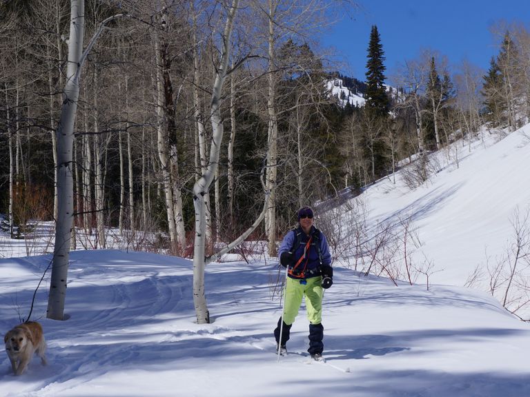
Horseshoe Canyon to Packsaddle Canyon (or reverse) is the most open of the five easily accessible canyons on the east side of the Big Hole Mountains (west side of Teton Valley, ID). The cross-country ski and fat-bike trail follows a groomed snowmobile trail over a forest service road that is part of a network of snowmobile trails groomed by the USFS with funds from snowmobile license sales. While snowmobile trails may deter some XC skiers, these trails are rarely used by snowmobiles mid-week and provide an enjoyable experience for cross-country skiing.
Parking: Park on the side.
Directions:
Beginnings: You can start from either the Horseshoe Canyon trailhead, up Old Horseshoe Road from W 1000 N (southern end), or from the northern end, from Packsaddle Road, west of Kay’s Dairy farm, west of W 4000 North. Locals prefer starting from the south (Horseshoe side) to avoid a steep uphill west of Kay’s Dairy farm on the north end.
Uphill Stretch: Starting on the northern end (Packsaddle side), depending on snow level, park at the end of the plowed road. Ski west uphill on the snow-covered road until the road divides approximately ¼ mile. Take the left fork and continue climbing a moderate hill, which then levels off after a forest clearing.
Views: To the left (east), the view opens up wide across the Teton River Valley to the west side of the Teton crest, with the Grand, Middle, and South Tetons in view. The trail (number 235) now heads south/south-west and winds around the mountain contours with rolling hills into conifer and aspen forests. At approximately 2.5 miles, the trail crosses a creek, then bends slightly to head in a general south-east direction.
Return: The trail finishes its gentle climb after another few hundred yards, then levels off and winds through more forest, passing side trails 914 and 910 on the right (west). These are dead-end trails but can be explored. The downhill begins and offers a fun ride down to the Horseshoe Canyon trailhead at mile 6 (alternate starting point). Return via the same trail, beginning with some nice uphill skiing, then rolling terrain. This trail is well protected from the wind, making it a great choice on a snowy, windy day.
A note for:
Dog owners: Dogs are welcome too!
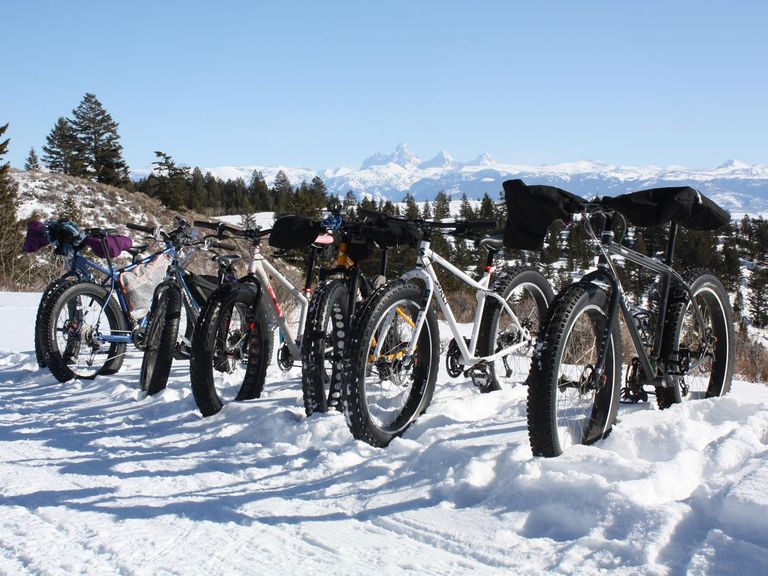
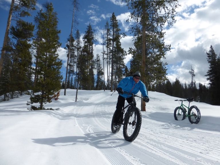
Fat Bikers: Packsaddle to Horseshoe Canyon is a fantastic trail for fat-bikers.
Summer Conditions: In the summer, this USFS forest service dirt road trail is suitable for a casual hike, gravel bike, or mountain bike ride, especially when single track trails are wet.