4.5 miles
Gros Ventre Road - East of Slide Lake
Gros Ventre & Wyoming Ranges
Fee: $0.00 - donations appreciated
Access:
via Gros Ventre Road east of Slide Lake. Park in the designated parking lot.
Description:
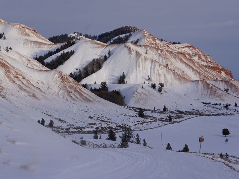
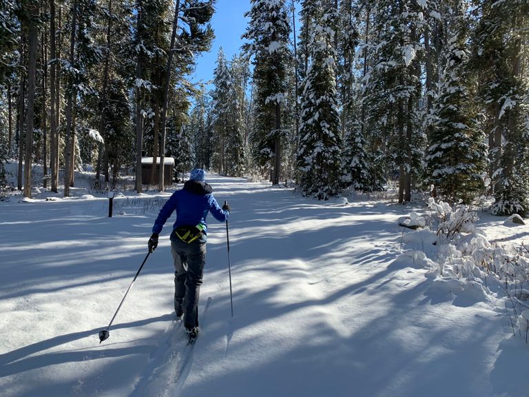
The trail, packed by periodic snowmobile tours, offers solitude amid the vastness of the valley. After approximately 3 miles, enjoy views of Red Rocks before reaching Crystal Creek, where the road descends to river level and crosses a bridge. Summer campgrounds like Red Hills and Crystal Creek are located north of the road. Return via the same route.
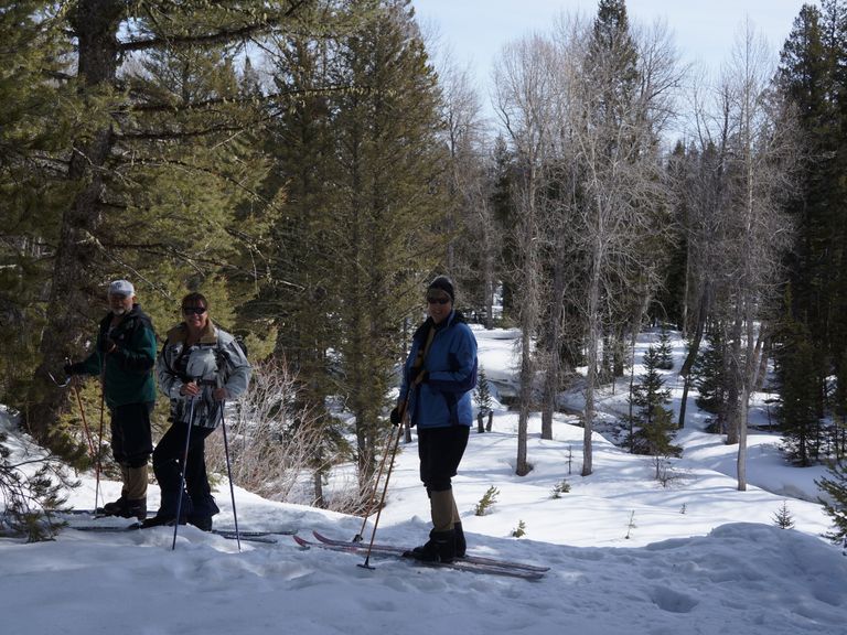
Skiing Experience: The trail offers an easy to moderate skiing experience, suitable for skiers of various skill levels.
Fat Bikers: Fat biking is permitted on the groomed trail during winter months.
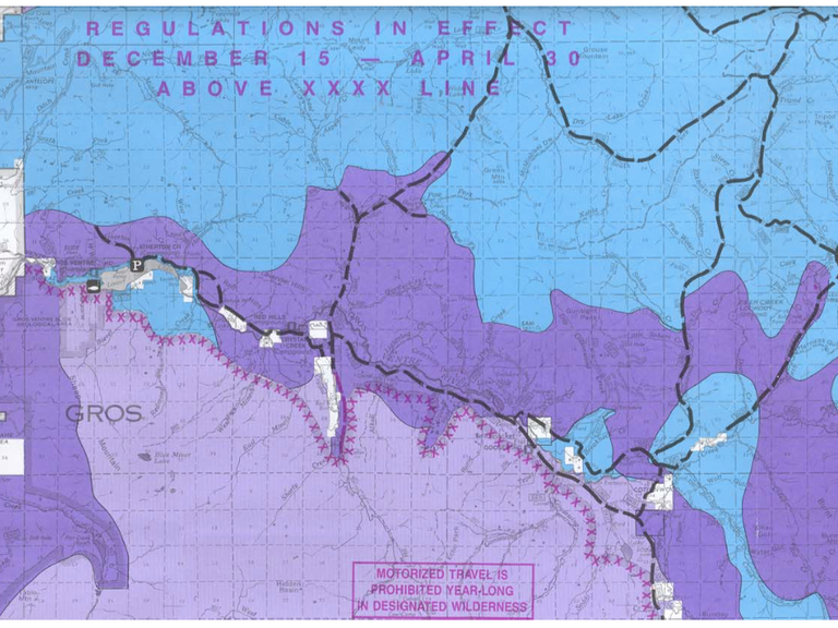
Winter Conditions: The trail is packed by periodic snowmobile tours. Check for Winter Wildlife Closure areas and observe signs along the trail. Snowmobile tours operate throughout winter, but encounters are infrequent, offering solitude on the trail.
Dog Owners: Dogs are welcome but must be kept on a leash.
Respect Wildlife: Please respect Winter Wildlife Closure (WWC) areas by staying on the groomed trail/road, as indicated by signs along the trail. The Alkali winter elk feed ground approximately 9.5 miles from the trailhead offers chances to observe elk herds on the slopes of the Red Hills and ridges.
Summer Conditions: In summer, the trail is a forest service road, occasionally dusty with vehicular traffic. Suitable for flat gravel biking, mountain biking, and hiking, with access to nearby hikes and the Gros Ventre River.
Directions:
The trail begins after passing through a "closed Road" gate onto a snow-covered, snowmobile track. Following the graded road east-southeast into the Gros Ventre Range along the Gros Ventre River Valley, the trail offers gentle rises and falls, passing historic ranches like Goose Wing Ranch and Red Rocks Ranch. Maintained by the Bridger-Teton National Forest Service, the track extends over 15 miles beyond the last ranch, providing opportunities for extended overnight trips.