28.7 miles
Taggart to Signal Mountain via Teton Park Road-Roundtrip
Grand Teton National Park
Fee: $0.00 - donations appreciated
Access:
Drive north on WY Hwy 89 from Jackson to Moose. Take the Inner Grand Teton National Park road 3 miles north past the GTNP Entrance (bring your pass – NPS fee applicable) to the Taggart Lake Trailhead parking. Note: the road is plowed up to this point.
Description:
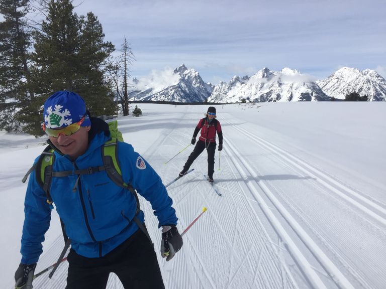
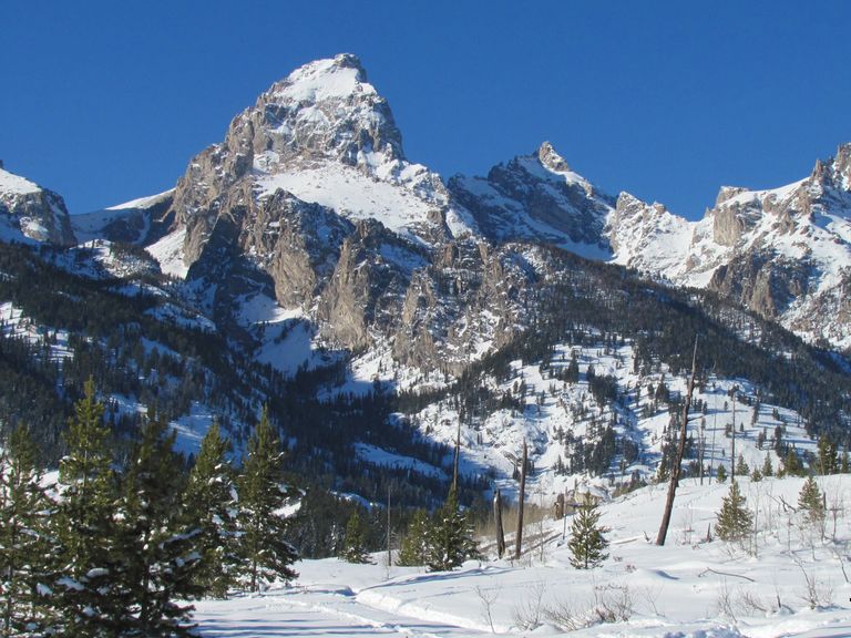
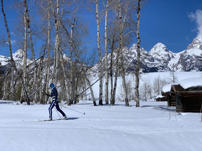
This groomed Nordic trail is possibly one of the most strikingly beautiful, iconic Nordic trails in North America, passing along the base of the core of the Teton Range in front of the Grand Teton, Teewinot, Nez Perce, and further along, Mt Moran. The views are breathtaking - equally dramatic on a clear sunny day as on a stormy cloudy day.
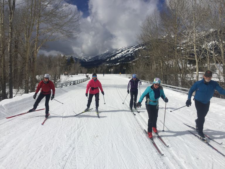
From the Taggart Lake parking lot, the groomed trail follows the Teton Park (Inner) Road north for 14.4 miles. The trail is groomed for both skate skiing (smooth and wide middle section) and classic cross-country (2 tracks on the right (east) side). The left side of the track is reserved for walkers & snowshoers.
The full Taggart to Signal Mtn Lodge Nordic ski trail is groomed once a week (Friday mornings), while the most popular stretch, Taggart to South Jenny Lake, is groomed once a week on Tuesday mornings. (sign-up for daily or weekly Trail Condition Reports on the JHNordic.com home page for the latest info).
Grooming is sponsored by the Grand Teton National Park Foundation, with support from the Jackson Hole Nordic Alliance and community organizations and skiers. If you enjoy this trail, we encourage you to make a contribution to enable the community to continue winter grooming – go to GTNPF.org/donate and specify “Nordic grooming”.
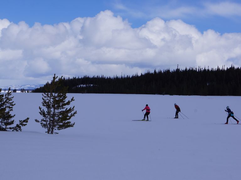
You can ski out as far as you like, then turn around and return, making this a flexible outing for distance. Some choose to ski all the way to Signal Mountain Lodge and ski back (the full 28.8 miles)– a fairly athletic endeavor! Another popular option is to arrange for friends to start on the Signal Mountain Lodge side and exchange car keys, so each ski group skis one way (the road is plowed from Moran Junction, crossing the Jackson lake Dam, to Signal Mtn Lodge parking lot.)
Trail description: Head north from the Taggart gate, the Grand Teton rising majestically overhead on a clear day, the traditional buck rail fence setting a classic scene. A half mile along, the trail crosses the Cottonwood Creek bridge, past which the vista of the full central and northern Teton Range opens up. This section, from Taggart to Jenny lake is the most popular section of the trail.
Grand Teton National Park provides Nordic Ski Ambassadors on the trail daily in season, to provide assistance and information –look for the red jackets (between Taggart and South Jenny Lake section).
The trail continues north, passing signs for the American Alpine Club climbers camp, Lupine Meadow, and South Jenny Lake (4.5 miles). Note: no amenities are open in the winter on this trail.
To the east is a large section of conifers, known as Timbered Island, where elk may be hiding.
Continue north, passing the turn-off on the left (west) first for the summer one way road for Jenny and String Lakes. At 7.3 miles, the road (not groomed) for North Jenny Lake and String Lake is on your left. Further along is the summer turnout for Mt Moran viewpoint, with a direct view of Mt Moran to the northwest. At 11.6 miles, the turnoff sign for the Potholes is on your right. Across the Snake River valley to the east is Mt Leidy, the northern most distinctive peak in the Gros Ventres Range.
At 13.25 miles is the Signal Mountain Road turnoff on the right. This road is not groomed, though there may be skier tracks. This is a nice side option to ski to the summit on classic skis. Elevation gain is approx. 850 feet.
At 14.4 miles, turn around and head back south, or ski past the winter closed gate to the plowed road and parking lot of Signal Mountain Lodge. The Lodge is closed for winter.
On your return journey, the views open up to the south and west. Wide views of Mt Moran and the Cathedral Group (Teewinot, Grand Teton, Mt Owen) meet the skier front and center.
Further south, Nez Perce (looks like the head of a wolf raising its head, howling!) emerges past Garnet Canyon. Then Buck Mtn can be seen, set back, a perfect triangle summit.
The last 4 miles are gently downhill for the home stretch back to Taggart trailhead…
Be sure to bring water, food, a warm layer, as weather can change quickly from a sunny day to a full winter snow storm. Be prepared!