5.9 miles
Mail Cabin Creek
Teton Valley
Fee: $0.00
Access:
From Jackson Hole, head west over Teton Pass on WY Hwy 22. Park on the north side of the highway in the Parking area for Coal Creek trailhead, 8.5 miles west of Wilson / 3 miles west of the summit of Teton Pass. If coming from Teton Valley, the Coal Creek parking area is on your left, 9.3 miles east of Victor.
Description:
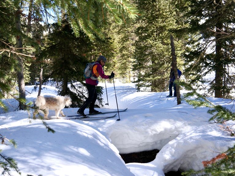
Mail Cabin Creek is a popular backcountry AT ski drainage, used by AT skiers for uphill access to several backcountry bowls and ridges in the northern Snake River Range. It also serves as a common exit route from these bowls and other favorites between Teton Pass and upper Mail Cabin, such as Columbia Bowl and further west.
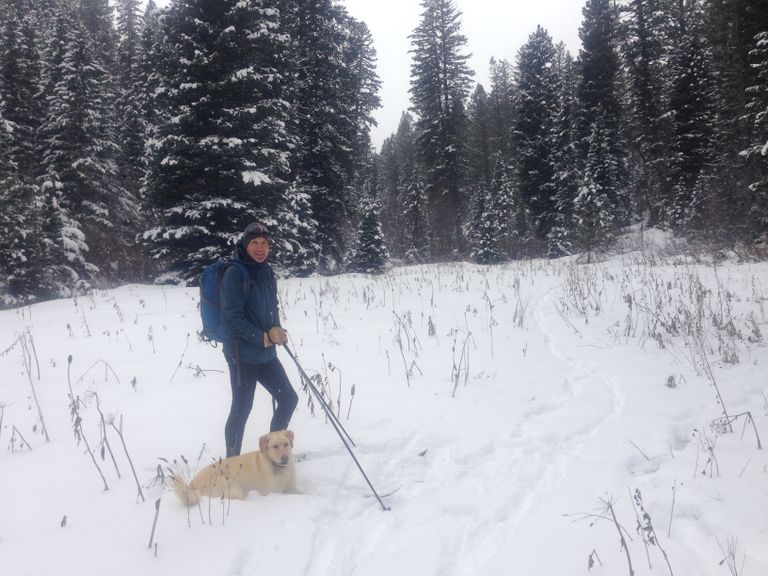
Skiing Experience: As a Nordic/skinny ski outing, skiing mainly takes place in the tracks of the AT skiers or involves breaking trail after new snow. The trail follows a meandering creek up into narrow valleys until the terrain becomes too steep to enjoy.
Directions:
Beginnings: Start by heading east along the flats with Teton Pass road (WY Hwy 22) on your left (north) and the creek (possibly snow-covered) on your right. Follow tracks through groves of trees and meadows, noting that the creek spreads out into multiple channels, covered by snow-bridges in mid-winter. After approximately 500 yards, the creek begins to turn south and enters a narrowing canyon. One can cross the creek at this point to the west bank (right side skiing up) and continue along a track that follows the west creek bank into the main canyon drainage.
Alternative Route: Alternatively, one can continue to follow the east bank of the main creek, traversing a medium steep side bank, until the trail opens up at the edge of an open meadow, the beginning of a side canyon to the east. The eastern creek drainage is enticing but does not go very far until the canyon narrows and becomes steep.
Extended Exploration: For extra mileage, one can ski this as a short out-and-back, then rejoin the main trail. Cross the main creek on the right (west) via a snow-covered log bridge and rejoin the principal ski track heading up into the west/main branch of Mail Cabin Creek.
Return: The main trail heads gradually uphill following the upper creek and a summer forest road, with periodic short climbs through tall stands of conifers. In total, this branch goes 3 miles from the trailhead up the creek to nearly 8000 ft, until the valley becomes too narrow and steep. Turn around here unless you want to venture into "extreme" skinny skiing (moving into AT skiing terrain). The ski out is rapid after having gained approximately 800 vertical feet.
Summer Conditions: In summer, this trail offers a delightful hike up to the ridgeline, with options to go east or west.